 GPRviewer
Inicio › Datos de georradar gratuitos
Datos de georradar gratuitos
Para aprender a leer un radargrama, probar un procesado o comparar antenas, nada mejor que medidas reales. GPRbase, la base de datos abierta de MDS, publica levantamientos de georradar reales, documentados y gratuitos, que puede abrir directamente en GPRviewer.
Abrir GPRviewer gratisCuenta gratuita, sin instalación, directamente en el navegador.
Cada conjunto de datos se describe en GPRbase (contexto, equipo, objetivos, verdad de campo cuando existe) y se descarga gratis. En GPRviewer, el botón «Ejemplos en GPRbase.com» de la pantalla de inicio abre el mismo catálogo. Los títulos están en inglés.
Cómo usarlos
- Elija un conjunto de datos más abajo y descárguelo de GPRbase (archivo ZIP).
- Abra GPRviewer y arrastre los archivos .DZT a la ventana.
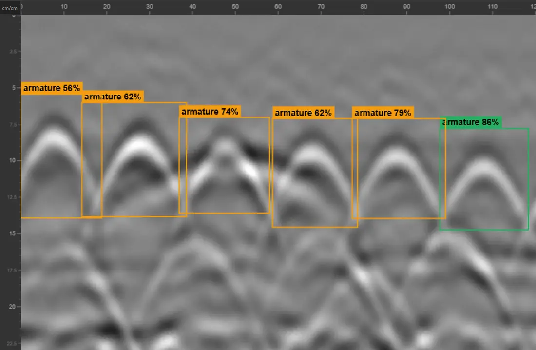
- Compare con la descripción del conjunto: en ella se señalan las armaduras, las redes, los huecos o las interfaces.
Hormigón y estructuras 20
- 3D Grid Concrete bloc wall with voids
- FLEX, NX25 and NX15 reference lines (MDSLab)
- Double layer of reinforcement and structural change (1 profile)
- Double mesh tightly embedded in a concrete slab with varying concrete cover
- FLEX 3D grid 60 x 60 cm (reinforced concrete beam and slab).
- Two layers of rebars in a reinforced concrete structure (3D grid)
- 3D concrete scanning over a slab-access ramp interface
- Voids in a concrete block wall
- Thickness detection above three masonry bridge arches
- Reinforced Concrete Slab with Expansion Joint
- 3D Grid on Reinforced Concrete — Welded Mesh Overlap for Rebar Picking
- 3D Grid on Densely Reinforced Concrete — Rebar Picking and C-Scan Tuning
- Beam-and-Block Floor — Cross-Polarisation on Inline and Cross-Line Channels
- Reinforced Concrete Column — Cross-Polarisation to Image the Far Face and Calibrate Permittivity
- Circular Reinforced Concrete Column : Perimeter Scan and Rebar Repositioning in Section View
- Reinforced Concrete Beam: Continuous Longitudinal GPR Survey with Markers at Two Columns
- T-Shaped Retaining Wall: Variable Thickness from a Vertical then Horizontal GPR Profile
- Reinforced Concrete Accessibility Ramp: Three Frequencies, Two 2.5 GHz Antennas and Cross-Polarisation on the Same Profile
- Formwork block Wall: 3D Grid Over a Void, 24 Crossing Profiles
- Pier shaft of a Toulouse Metro Line C viaduct with step-frequency GPR
Redes enterradas 7
- Detection of various buried utilities using a dual-frequency antenna (300 MHz and 800 MHz)
- Ground-penetrating radar detection of gas connections (HDPE polyethylene)
- Detection of buried pipes with the NX15 step-frequency ground-penetrating radar antenna
- Unrecorded Utility Crossing Under a Street — Parallel GPR Profiles at 350 MHz
- Georeferenced Multi-Utility Mapping - 30 RTK GPR Profiles at 300/800 MHz
- Multiple Utilities and Airwave — Distinguishing Surface Reflections from Buried Targets
- Buried utility crossing and two metal manhole covers — dual-frequency Compass NX profile (.nx)
Geotecnia y firmes 1
Patrimonio y arqueología 2
geotech,geosciences 2
geotech,routes 1
reseaux,geosciences 1
beton,reseaux 1
geotech,beton,reseaux 1
reseaux,beton 1
beton,geotech 2
Preguntas frecuentes
¿Dónde encontrar datos de georradar gratuitos?
En GPRbase.com, que publica levantamientos GSSI reales con su contexto. Se abren gratis en GPRviewer.
¿Puedo utilizarlos para una formación o una publicación?
Sí, en las condiciones de la licencia indicada en la ficha de cada conjunto de datos.
¿Qué formatos?
Principalmente archivos GSSI .DZT, a veces acompañados de archivos .DZX, de trazas GPS o de archivos Compass (.nx).
Véase también
Abrir un archivo DZT · Abrir un archivo NX · Software de escaneo de hormigón · Localización de armaduras con georradar · Software para StructureScan Mini XT · Software para UtilityScan · Software para SIR 4000 · Fin de RADAN: alternativa · Software de georradar gratuito · Versión Pro · API de Punteo IA
Abrir GPRviewer gratis