 GPRviewer
Home › UtilityScan software
UtilityScan software
The GSSI UtilityScan and UtilityScan DF are ground penetrating radars for locating buried utilities: pipes, cables, ducts and voids. GPRviewer opens their .DZT files in your browser to review the survey, measure depths and share clear images with your client.
Open GPRviewer for freeFree account, nothing to install, runs in your browser.
Both frequencies of the UtilityScan DF
The UtilityScan DF records two frequencies at once (300 and 800 MHz). GPRviewer reads both as two channels: channel 1 for the high frequency, detailed near the surface, channel 2 for the low frequency, which sees deeper. The Pro version can also blend the two channels into one image.
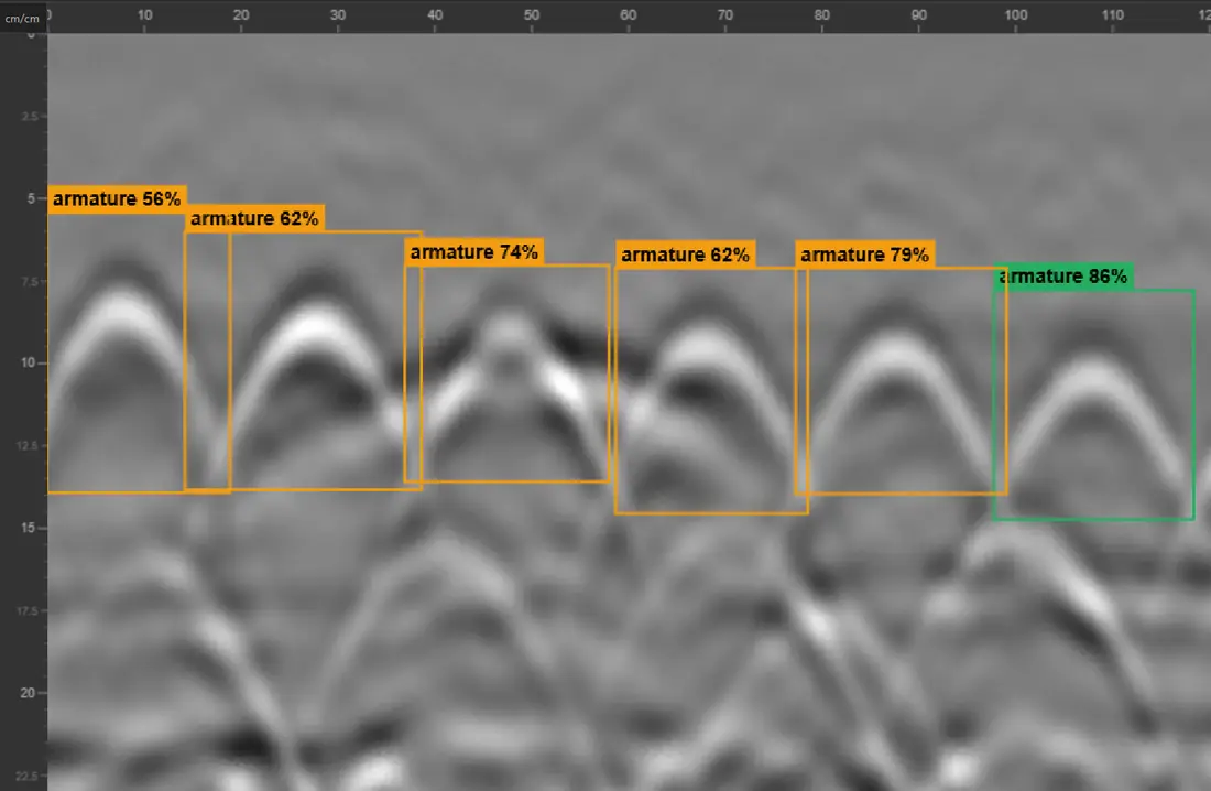
Measuring the depth of a utility
- Set the dielectric constant of the soil, or fit a hyperbola on a pipe to measure the velocity directly from the scan.
- Read the depth of the apex of each hyperbola with the measurement tool.
- Trace interfaces (layers, trench bottoms) and read their depth along the profile.
- Remove background noise and apply frequency filters adapted to each antenna.
Surveys on a map
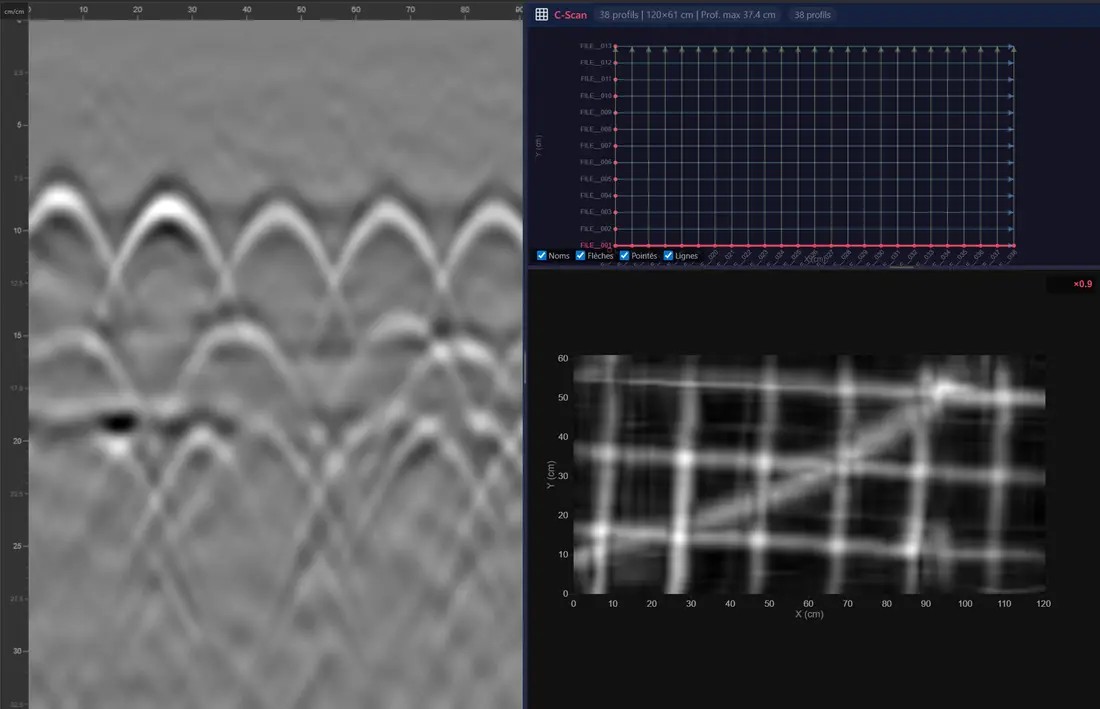
When the survey was recorded with GPS positions, the profiles can be displayed on a map, and a set of parallel profiles can be turned into a C-Scan plan view to follow a utility across the area (Pro).
Frequently asked questions
Can I open UtilityScan DF files without RADAN?
Yes. GPRviewer reads the .DZT files of the UtilityScan and UtilityScan DF in the browser, with both DF frequencies.
Is it free?
Opening, display, gain, color maps, depth calibration and PNG export are free. Filters, hyperbola fitting, channel fusion, C-Scan and the GPS map are part of the Pro version.
Are survey marks shown?
Yes. Marks recorded during the survey (in the .DZT file or its .DZX companion) are shown on the radargram.
Can I share results with a client who has no GPR software?
Yes. Export PNG images of the annotated radargram, or let your client open the files in GPRviewer with a free account.
See also
Open a DZT file · Open an NX file · Concrete scanning software · Rebar locating with GPR · StructureScan Mini XT software · SIR 4000 software · RADAN discontinued: alternative · Free GPR software · Free GPR data · Pro version · AI rebar picking API
Open GPRviewer for free